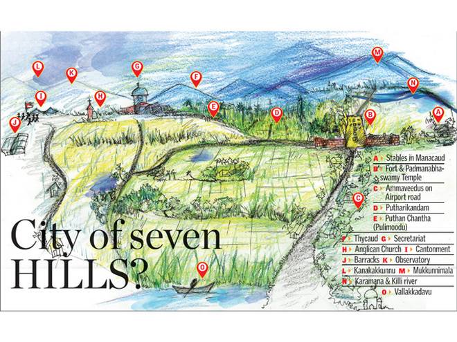
Is the capital city of Kerala built on seven hills? On the occasion of World Heritage Day, the author turns the pages of history to read about the landscape of the city as it was many years ago.
If one looks up Wikipedia on ‘Cities on Seven hills’, dozens of cities claim to be established on seven hills. Rome, Athens, Tehran, Mecca, San Diego, Kampala and Thirumala (in Thirupati) are on the list. A surprising entry is that of Thiruvananthapuram.
In many writings of the 20th century we can see this claim. The late Pattom G. Ramachandran Nair, historian, who compiled a voluminous treatise on ‘Trivandrum’, for instance, describes it being built on seven hills, like Rome. However, if we start counting the hills in the city, it becomes confusing. Hills there are, but to decide on the seven that the city rests on, is near impossible. The really high hills are outside the city.
Agasthiarkoodam or Agasthya Mala (1,868 metres) and Ponmudi (1,100 metres) are both about 60 km from the city. Mukkunnimala (252 metres) is the closest one (11 km away, near Pappanamcode) and, in fact, it is a landmark of the city for mariners.
Another question pertains to the area that is to be considered as the “city”. The modern city limits and the historic town limits are different. The seven-hills claim is related to the 19th or early 20th century town limits, which was smaller than the city limits of today.
Ward and Conner write in 1827 (based on their surveys that took place between 1816-1820) that the “ the town [Trivandrum] commences a short distance west of the [Killi] river and the road runs north to the cantonement [Palayam] through Puthenchanthai [present Pulimoodu] . The town from north-west to south-west is nearly two miles, including the Fort about the centre“.
In 1839, William Henry Horsley who wrote the Memoir of Travancore (and who designed the Karamana Bridge) also describes the city in almost the same way: “To the east of the fort is an extensive line of native shops, called shala bazar, through which the main road from south passes . Leaving this bazaar [entering east Fort-bus stand area], the road takes a turn to the north and proceeds through Pootenshanday, to what is called the cantonment … the town extents in a SE direction to Manacaud, where there is a bungalow and garden called “singaura tope” [now the Karimadom Colony] . The stables for the rajahs’ body guard and private stud are situated near the SE angle of the fort. The city has a population of about 12,000.”
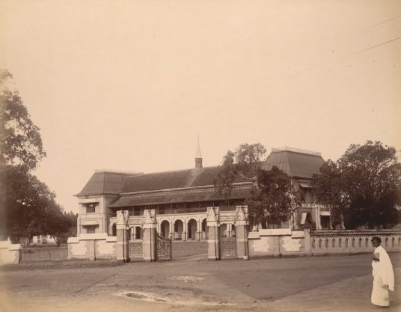
Mrs Murray Mitchell in her book In Southern India mentions her visit to ‘Trivandrum’ in 1885 when she was a guest of Mr. Ross [whose residence in Vazhuthacaud was Ross House, now transformed to ‘Rose’ House], the then Principal of University College. She obviously saw a panoramic view of the city that has been lost forever behind the towering cityscape: “Trivandrum is a most beautiful place, full of picturesqueness, and all the loneliness which knolls, and hills, and verdant undulations with some good buildings, and the richest tropical foliage can give. The mingled rocks and hills, green valleys, lofty mountains with rich vegetation, the palm groves and rice fields and water altogether make as lovely a panorama as ones eyes could wish to look upon.”
The town of ‘Trivandrum’ thus seems to have been a small area covering Fort, Chala, Valiashala, Attakulangara, Manacaud, Pettah, Vanchiyoor, Palkulangara, Perunthanni, Pulimoodu, Palayam, Observatory-Museum area and Thycaud. Approximately, it is a circle with the present MG road (extending from Fort area to Museum area) as its diameter.
Ward and Conner did see rising grounds in Trivandrum. They wrote: “Trevandrum or Thiruvananthapuram is a very opulent and extensive town situated on a rising ground between valleys of wet cultivation and shaded by groves of cocoanut and other trees. The British residency stands on an elevated spot commanding the Thycaud valley and surrounding country. Pootencottah, a halmet,… at a commanding height, situated between the Killiyaur and a street of wet cultivation… on the summit of it is a ruined fortress or prison. At the southern base is a quarry of white stones“.
As late as in 1950, a foreigner who worked as a teacher in Zenana mission school wrote “[Trivandrum] is three miles distant from the sea. It is a spacious and pleasant place, not at all built up. Indeed a few rice fields seem surprisingly to have strayed into the very centre. The north eastern environs are gently slopped to rise to several low hills. On one of these is the observatory and from this vantage point, it is possible to look down upon a waving sea of green coconut palm fronds which so completely cover the town”.
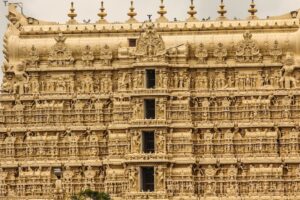
One chain of hills that anyone would easily miss while looking for hills in the city is the Mahatma Gandhi Road itself. If one were to drive from the seashore near the airport to the city, towards Sree Padmanabhaswamy Temple though the ‘Arat’ road, the road is almost flat with a gentle upward slope. The Padmanabhaswamy Temple is on a raised ground of a few metres, one does not know if it was a hill or simply an artificially raised platform. If we go around the temple, we see flat roads. But as you start your journey though the MG road from the East Fort, you start ascending gradually. By the time you reach Ayurveda College, you are almost 40 metres above the sea level and you are on top of the longest, though not the highest city ‘hill’. The ‘MG Road hill’ runs right up to Palayam with wide hill tops in Statue and Palayam. As you continue on the MG road, you notice that all the roads on both sides slope downwards. You then realise that you are on a hill top. At Palayam, the hill tops are quite wide and cover the University Office Campus, Niyamasabha complex and some lower elevations of the hill spread to even the General Hospital area. The hill does not end at Palayam. It takes a right turn towards Vellayambalam. The Zoo and Museum are on one of the elevations and a little further there are two prominent ‘hills’ on the left and right, the Kanakakkunnu and the Observatory/Water Works hills.
One more elevated area can be seen at Vellayambalam – the campus of Keltron & C-DAC (a spot traditionally known as residence of the six-speed singer Shadkala Govinda Marar; some also say he stayed at Thonnal temple beyond Kazhakoottam). Still further, the hill extends towards Kowdiar, Sasthamangalam and to Cotton Hill. The road to Kowdiar has small elevated areas on both sides, the prominent one being the Rajbhavan campus. Symmetric to Cotton Hill, on the opposite side of the MG road, we have Barton Hill.
(This is the first of a three-part series on the hills in and around the city) Credits: TheHindu


